Share this article:
How did this Texas city get where it is today? What major developments have changed the physical landscape, skyline, and lifestyle in Austin the most?
Incredibly popular with millennials, Austin owns plenty of accolades from ‘Live Music Capital of the World’, to ‘Silicon Hills’, and ‘City of the Violet Crown’ for the lights on the horizon. Austin is also respected for having clean air, and being ranked as one of the safest cities in the US. This is a top-jobs and tech city, which may only have been lacking in the walkability department. This too may be changing with a surge in urban downtown development.
Together with data from the University of North Texas and Google, we have compiled a series of snapshots of Austin now versus a hundred year ago, more or less. Check out where we were then and where we are today, by sliding the arrows on the pictures:
1. Congress Avenue Bridge – Looking north towards the Capitol Building
Year: 1900
Looking north on the Congress Avenue Bridge we can see that despite Austin’s reputation as a low-rise city a significant amount of glass and steel has sprung up, with a variety of architectural designs. Now known as the Ann W. Richards Congress Ave Bridge it is most famous for its population of as many as 1.5 million bats.
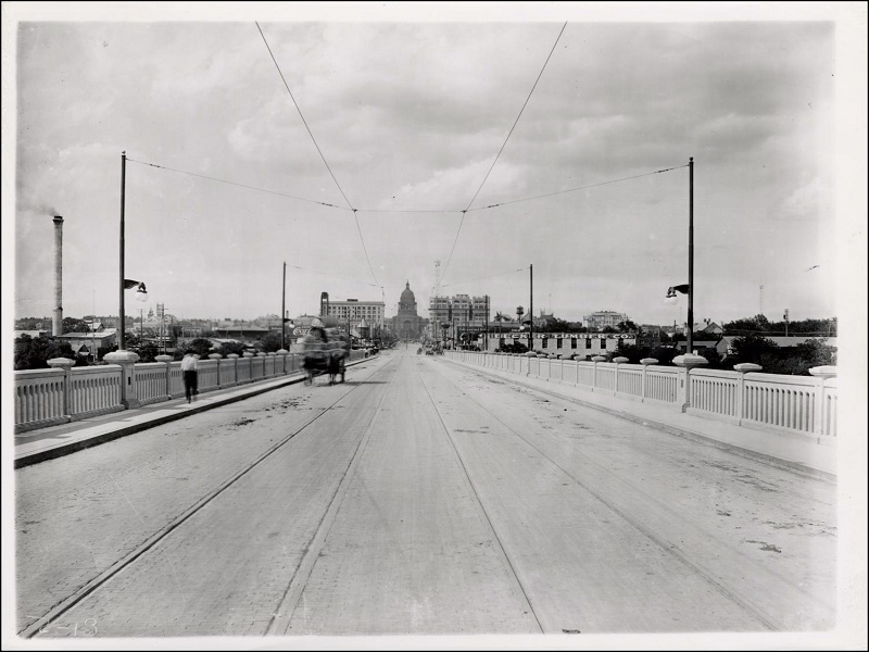

Photo Credit 1908: The Portal to Texas History; Photo Credit 2016: Google Maps
Use the code below to embed the image on your website:
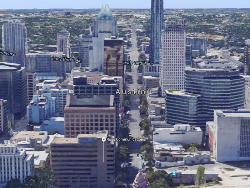
2. Congress Avenue – Looking south from Capitol Building
Year: 1900
Looking south along Congress Avenue. Back then it was gas street lights, mule driven street cars. Still a main thoroughfare today’s Congress Avenue is paved, busy with yellow cabs and lights. Now instead of having to browse the bakery at the right time of day local urban residents can enjoy an array of food deliver services including UberEATS.
 [/before-after]
Photo Credit 1900: The Portal to Texas History; Photo Credit 2015: Google Maps
Use the code below to embed the image on your website:
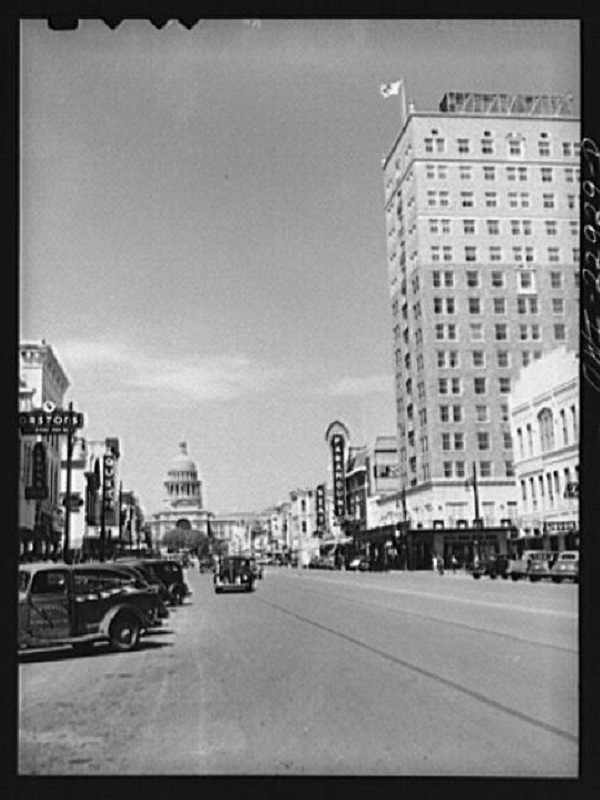
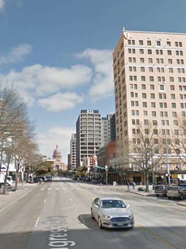
3. State Capitol – Street view of State Capitol
Year: 1900
The State Capitol building may not be as visible as it once was, but even minus the parking on Congress Avenue this is still one of the busiest stretches of the city. Note the addition of the newer 823 Congress building at 9th Street. Today it is a busy office building for lawyers and financial firms. Appearing in both photos, on the right side of Congress Avenue, is Austin’s first high-rise hotel, InterContinental Stephen F. Austin, named after the “father of Texas,” built in 1924 and renovated in 2013.
 [/before-after]
Photo Credit 1943: Library of Congress; Photo Credit 2016: Google Maps
Use the code below to embed the image on your website:
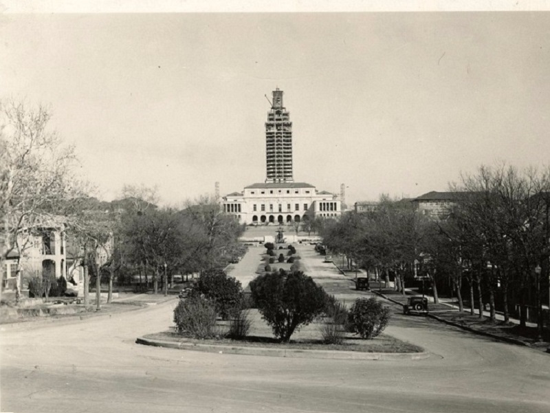
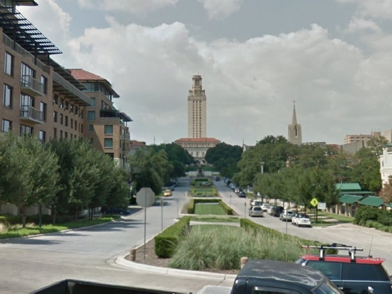
4. UT Tower – View from Olive and 5th Street
Year: 1936
View of the University of Texas Tower from Martin Luther King Jr. Blvd. Note the expansion of new educational facilities on the left, and churches along the right. Fortunately Austin appears to have maintained its green spaces and dedication to education, even if its housing has become more vertical.
 [/before-after]
Photo Credit 1936: The Portal to Texas History; Photo Credit 2014: Google Maps
Use the code below to embed the image on your website:
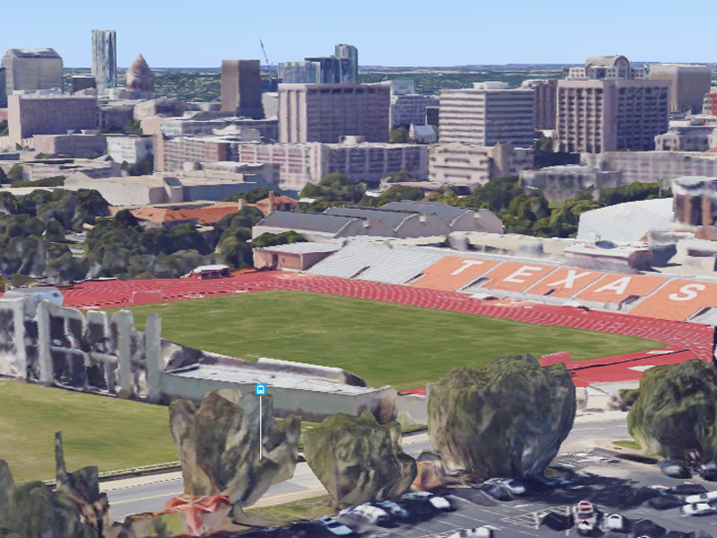
5. Memorial Stadium – Aerial view of stadium
Year: 1924
See the War Memorial Stadium and the UT band forming a T in the center of the field. When originally constructed the stadium had a capacity of just 27,000. After additions in 2009 the capacity rose to over 100,000 making it one of the ten largest in the world. Now known as the Darrell K. Royal – Texas Memorial Stadium.

 [/before-after]
Photo Credit 1908: The Portal to Texas History; Photo Credit 2016: Statesman
Use the code below to embed the image on your website:
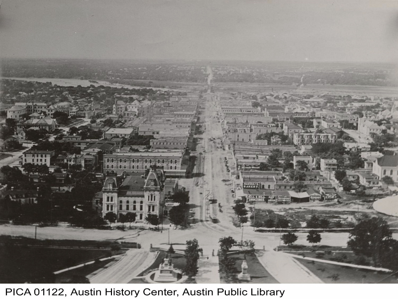
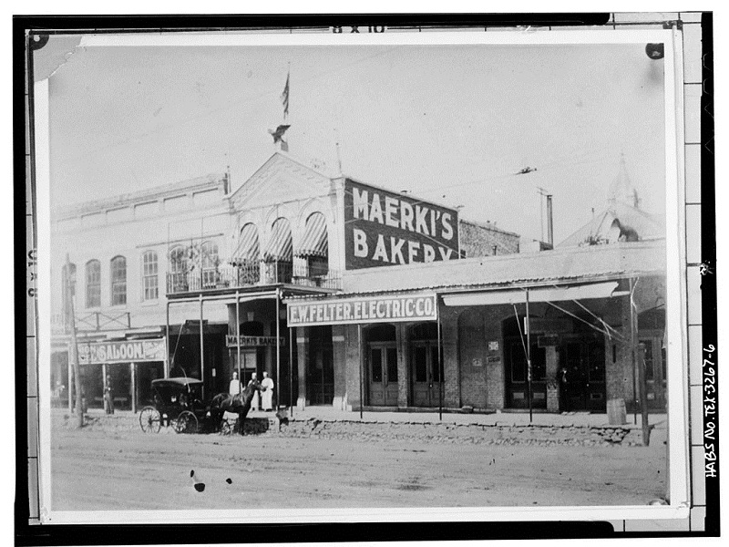
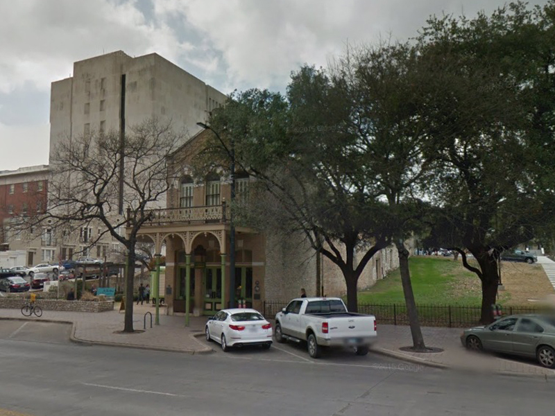
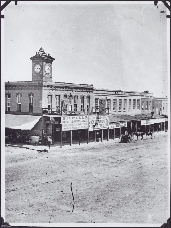
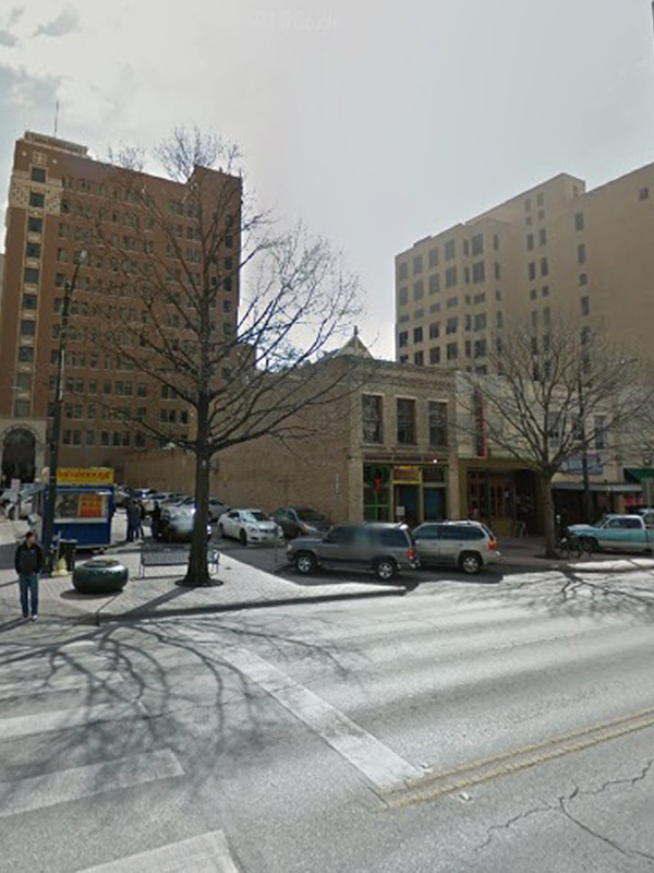
6. Old Bakery and Emporium Park – Street view of Old Bakery and Emporium Park
Year: 1890s
A lot of the scenery may have changed since old Maerki’s Bakery was first built in Austin, but it’s still there. The horses and carts are gone, the buildings are taller, and there may even be more green space. Yet, the Old Bakery and Emporium remains a historic and active building. It now houses a museum and art gallery.
 [/before-after]
Photo Credit 1890: Library of Congress; Photo Credit 2014: Google Maps
Use the code below to embed the image on your website:
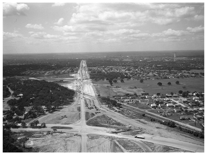
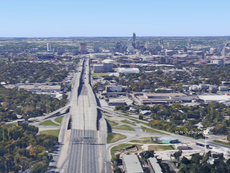
7. IH 35 – Arial view of IH 35
Year: 1950
This view of Austin shows the IH 35 highway under construction, and the site of the first shopping center in Austin – the Hancock Center. I-35 was the city’s first major highway. It has certainly grown wider and busier over the years, and also houses its own bat colony underneath, which is an offshoot of the one under Congress Ave Bridge.
 [/before-after]
Photo Credit 1950: The Portal to Texas History; Photo Credit 2016: Google Maps
Use the code below to embed the image on your website:
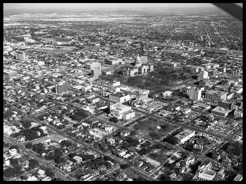
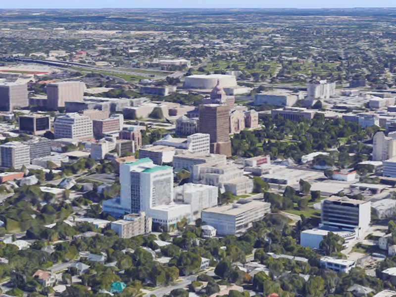
8. Downtown – Aerial view of Downtown Austin
Year: 1965
Check out the aerial view of downtown Austin, the State Capitol building, and in particular the Travis County Law Library at 314 W 11th, which was formerly the Lowich Building. In spite of great growth and even the construction of high rise towers along the Colorado River Austin still remains very flat, and sports plenty of open space.
 [/before-after]
Photo Credit 1965: The Portal to Texas History; Photo Credit 2016: Google Maps
Use the code below to embed the image on your website:
9. Congress Avenue at 7th Street – Looking south down the east side of Congress Avenue
Year: 1878
This street view of Congress Avenue and 7th Street shows that even though Austin has seen a rise in building heights, diversification, and popularity, it has also strived to retain its soul and history. You still see small shops, technology is still central to the economy, while sleeker, more recent structures have attempted to remain architecturally interesting.
 [/before-after]
Photo Credit 1908: The Portal to Texas History; Photo Credit 2014: Google Maps
Use the code below to embed the image on your website:
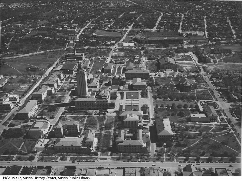
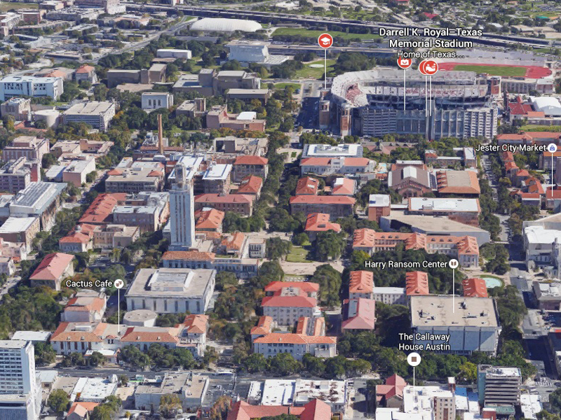
10. The University of Texas – Aerial view of the University of Texas
Year: 1940s
The University of Texas at Austin campus has clearly developed and filled in over the last six decades. The stadium has grown. The UT Tower in the center remains one of Austin’s icons. One the front of the main building the inscription reads “Ye shall know the Truth and the Truth shall make you free.”
 [/before-after]
Photo Credit 1940: The Portal to Texas History; Photo Credit 2016: Google Maps
Use the code below to embed the image on your website:
Fair use and redistribution
We encourage you and freely grant you permission to reuse, host, or repost the images in this article. When doing so, we only ask that you kindly attribute the authors by linking to RentCafe.com or this page, so that your readers can learn more about this project, the research behind it and its methodology.
Share this article:

Nadia Balint is a senior creative writer for RENTCafé. She covers news and trends in residential and commercial real estate and their impact on our everyday life, including rental housing, for-sale housing, real estate development, homeownership, market reports, insurance, landlord-tenant laws, personal finance, urban development, economy, sustainability, and social issues. Nadia holds a B.S. in Business Management from Northeastern Illinois University in Chicago. You can connect with Nadia via email.
Nadia’s work and expertise have been quoted by major national and local media outlets, including CNN, CNBC, CBS News, Curbed, The NY Post, The Chicago Tribune, The Denver Post as well as industry publications, such as GlobeSt, Bisnow, Inman News, Multifamily Executive, and The Commercial Real Estate Show. Nadia also wrote for Multi-Housing News, Commercial Property Executive, HubSpot, and more. Prior to entering the real estate industry, Nadia worked in the legal field, where she gained over 10 years of experience in business, corporate, and real estate law.
The Ready Renter has your back
Tips, news, and research curated for renters, straight to your inbox.
")

")

Related posts
Walk in Hamilton’s Shoes: 8 Iconic Locations from the Musical [Then and Now Photos]
Article updated June 2020 Hamilton has been hugely popular over the past few years, with premiere after premiere, Lin-Manuel Miranda hosting SNL, a PBS documentary……
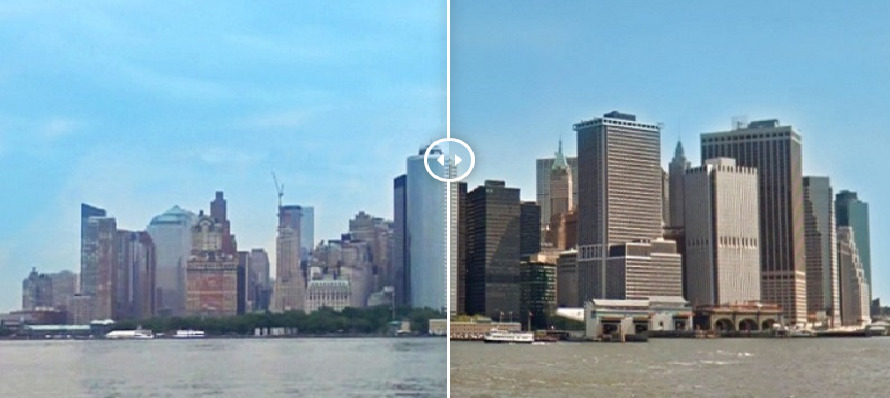
Time-Lapse Slides Show the Most Spectacular Skyline Changes in the U.S. in the Last Decade
The top growing cities in the country are among the largest U.S. cities, according to the newest U.S. Census population data. In other words, the…
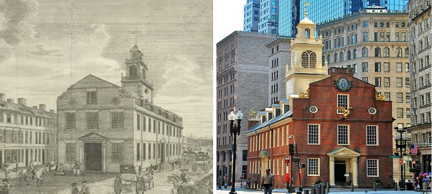
Video: Blending Boston’s Historic Places with Modern Day Life in One Cool Then-and-Now Video Tour
Since its founding in 1630, Boston has been a pivotal center of American and world history, philanthropy, education, innovation, and entrepreneurship. Although many of the…
Subscribe to
The Ready Renter newsletter