Share this article:


Oakland sits at the center of the Bay Area’s transit map, which matters more than almost any other factor when you’re comparing apartments. Trains, buses and ferries all converge here, making a car-free routine realistic for a lot of renters.
The city’s layout helps. The flatlands run on a grid of long north-south corridors like Broadway, Telegraph, San Pablo and International Boulevard, and most frequent transit follows those lines. The hill neighborhoods are a different story, with steeper grades, fewer routes and longer waits.
This guide explains each mode, who it serves best and where the gaps are, so you can weigh transit access alongside rent and square footage before you sign a lease.
Quick highlights:
- Oakland's transit network covers rapid rail, bus rapid transit, local and Transbay buses, ferries and regional trains.
- Eight BART stations serve the city, from West Oakland to Rockridge to the Coliseum.
- Many apartments in Oakland sit within a short walk of a station or a frequent bus line.
- One Clipper card or contactless card works across nearly every operator, with transfer credits between them.
Quick rundown of Oakland public transit
BART
BART is the backbone of getting around Oakland and the reason so many renters here skip car ownership. Eight stations serve the city: West Oakland, 12th St/Oakland City Center, 19th St/Oakland, Lake Merritt, MacArthur, Rockridge, Fruitvale and Coliseum. All five color-coded lines pass through, with MacArthur and 19th Street acting as transfer points.
Why renters rely on BART:
- Downtown San Francisco through the Transbay Tube, often in under 10 minutes from West Oakland
- Direct connections to Berkeley, Richmond, the Tri-Valley, Fremont and San Jose
- An automated connector from Coliseum station to Oakland San Francisco Bay Airport (OAK)
Trains run roughly 5 a.m. to midnight on weekdays, with no overnight service. Most lines come every 20 minutes, with shorter effective waits toward San Francisco. Fares are distance-based and rose 6.2% on Jan. 1, 2026, to an average of $5.18 per trip.

AC Transit local buses
AC Transit runs about 130 routes across western Alameda and Contra Costa counties, carrying roughly 160,000 riders on an average weekday. It’s the layer that fills in everything BART doesn’t reach: grocery runs, school drop-offs, medical appointments and the last mile home.
What AC Transit buses offer renters:
- Frequent trunk routes on Broadway, Telegraph, San Pablo and MacArthur
- Direct links to Kaiser Oakland, Highland Hospital, Laney College and Merritt College
- Fares of $2.75 on Clipper or $3 in cash as of July 1, 2026, with a $6 day pass
One caveat: a redesign called Realign changed or eliminated 104 lines in August 2025, so check current schedules rather than an older map.
Tempo bus rapid transit
Tempo, listed as Line 1T, is the closest thing Oakland has to a surface metro: 9.5 miles and 34 stations from the Uptown Transit Center at 19th St/Oakland BART down International Boulevard to San Leandro BART, with a BART connection at each end.
Benefits of Tempo service:
- Buses every 10 minutes from 6 a.m. to 7 p.m., with service around the clock
- Dedicated lanes, all-door boarding and signal priority for much of the route
- Fast access to the dense, more affordable corridor through San Antonio, Fruitvale and Elmhurst
With more than 17,000 weekday boardings, Tempo is AC Transit’s busiest route, and renting near a station buys you frequency most bus riders don’t get.
Transbay buses
If your job is in San Francisco but your apartment isn’t near BART, AC Transit’s Transbay network is the alternative. Fourteen lines make roughly 350 trips each weekday into and out of downtown San Francisco.
Transbay highlights for renters:
- Neighborhood stops closer to home than the nearest BART station, including Grand Lake, Piedmont Avenue and Montclair
- Arrivals at the Salesforce Transit Center, steps from the Financial District and SoMa
- Park-and-ride lots at Fruitvale Avenue and Grand Avenue
A single ride is $6.50 and a 31-day pass is $234, which also covers local trips. Build in a buffer for bridge traffic.

San Francisco Bay Ferry
The San Francisco Bay Ferry leaves from the Oakland Ferry Terminal at Clay Street in Jack London, reaching the Downtown San Francisco Ferry Building in about 15 to 25 minutes. A weekday route also serves Oyster Point in South San Francisco.
Why renters choose the ferry:
- Guaranteed seating and table space, which turns the commute into usable time
- No bridge traffic and no tunnel crowding
- A free Oakland Alameda Water Shuttle across the estuary, Tuesday through Sunday
Sailings are less frequent than BART trains, so the ferry suits renters with predictable schedules or hybrid weeks.
Capitol Corridor and Amtrak
Oakland has two Amtrak stations, Jack London Square and Oakland Coliseum, and every Capitol Corridor train stops at Jack London Square. The line runs 15 round trips on weekdays and 11 on weekends between San Jose, Oakland, Berkeley, Davis and Sacramento.
Travel times and one-way fares from Oakland Jack London:
| Destination | Travel time | One-way fare |
|---|---|---|
| Berkeley | 15 minutes | $5 |
| San Jose | 1 hour 15 minutes | $17 |
| Sacramento | 2 hours | $30 |
For most renters this is a weekend and occasional-travel tool rather than a daily commute. Only seven of the 15 weekday round trips continue south of Oakland, and the Amtrak bus connection to San Francisco leaves from Emeryville, not Oakland.
Lyft Bike and cycling
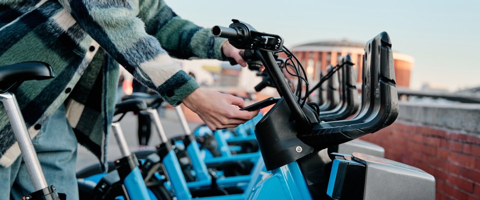
Bikeshare was renamed from Bay Wheels to Lyft Bike in July 2026. The regional system has more than 7,000 bikes and e-bikes at roughly 550 stations across Oakland, Berkeley, Emeryville and San Francisco.
What Lyft Bike offers renters:
- A last-mile option between BART and neighborhoods like Temescal, Pill Hill and Adams Point
- Clipper card unlocking at docking stations, and e-bikes that make the hills manageable
- Discounted memberships through Bike Share for All for renters on CalFresh, Medi-Cal or PG&E CARE
Oakland keeps adding protected bike lanes, so ask whether a building has secure bike storage.
Late-night buses and paratransit
AC Transit’s All Nighter buses cover the hours when BART is closed, with a transfer hub on Broadway between 13th and 15th streets. Line 800 crosses the Bay Bridge overnight, which matters for late-shift workers.
East Bay Paratransit provides door-to-door van service for riders whose disability prevents them from using regular buses and trains, within three-quarters of a mile of an operating route. Oakland residents 70 or older, or with a mobility disability, may also qualify for the city’s OPED program.
Does public transit matter when apartment hunting in Oakland?
It matters a great deal, and the gap between neighborhoods is stark. An apartment in Downtown Oakland or Rockridge puts two or three modes within a 10-minute walk. A place in the hills above Highway 13 might mean a bus every 30 minutes and a steep walk to reach it.
When comparing listings, run through this checklist:
- How far is the nearest BART station? Under 10 minutes on foot is excellent. A 15- to 20-minute walk is workable if the route is flat and well lit.
- Which AC Transit lines serve the block, and how often? Check evening and weekend frequency, not just weekday peaks.
- Does your actual commute work? Try the trip at your real departure time, not at noon on a Saturday.
- Can you walk to groceries and a pharmacy? Transit access means less if daily errands still require a car.
One thing to watch: Bay Area transit agencies face large operating deficits, and a regional sales tax measure called Connect Bay Area is on the November 2026 ballot. BART and AC Transit have published contingency plans with reduced service if it fails, so recheck service levels when your lease comes up.
Renting with Oakland public transport in mind
Oakland gives renters an unusual range of options for a city its size, and most people end up using two or three. Ride a few before you decide: take BART at 8 a.m. on a Tuesday, catch a Tempo bus down International, then walk from a listing to the nearest stop and time it. Ten minutes of homework can save you an hour a day for the length of your lease.
FAQ
A: Yes. Renters in Downtown, Uptown, Jack London, Temescal, Rockridge, Adams Point and along the International Boulevard corridor manage without cars, though hill neighborhoods and parts of East Oakland are harder to navigate car-free.
A: Downtown Oakland, Uptown, Jack London, Temescal, Rockridge and West Oakland combine BART, multiple bus lines and walkable streets.
A: Clipper works on BART, AC Transit, the ferry and Capitol Corridor. Contactless bank cards and mobile wallets are accepted at BART gates and on AC Transit buses. Transferring between agencies within two hours earns a credit of up to $2.85.
A: BART takes roughly 10 to 20 minutes depending on your station, the ferry from Jack London Square takes 15 to 25 minutes and a Transbay bus varies with bridge traffic.
A: BART closes around midnight, but AC Transit’s All Nighter lines, including Line 800 across the Bay Bridge, cover the late-night and early-morning hours.
Share this article:


Florin Petrut
Florin Petrut is a real estate writer and research analyst with RentCafe, using his experience as a social media specialist and love for storytelling to create insightful reports and studies on the rental market. With a strong interest in the renter experience, he develops data-driven resources that explore cost of living, affordable neighborhoods, and housing trends, helping renters make informed decisions about where and how they live. Florin holds a B.A. in Journalism and an M.A. in Digital Media and Game Studies.
Sign up for The Ready Renter newsletter
Get our free apartment hunting guide — plus local insights, trends and research.




Related posts

Detroit vs Chicago: Which Midwest city is more affordable for renters?
Detroit and Chicago are about 280 miles apart, making a move between the two a realistic option for many Midwestern renters. Maybe you’ve landed a…
Public transit options for renters in Newark, NJ: How to get around without a car
Newark renters can live car-free using PATH, NJ Transit rail, the Newark Light Rail and an extensive bus network, with Manhattan reachable in about 20…

Lining up apartment tours in Nashville, TN? Ask these questions first
Nashville runs on two engines that rarely slow down: health care and music. It’s a city where a hospital shift change, a songwriter’s set and…
Subscribe to
The Ready Renter newsletter